- Working at KSC
- NASA Old Headquarters building on KSC destroyed.
- Flintknapping points
- Vampires of Kennedy Space Center and the O&C
- Demons of Kennedy Space Center
- Demons of Kennedy Space Center, corpus callosotomy
- Ghosts of Kennedy Space Center, End of Spiders
- Dreams of Kennedy Space Center, lovers and pyramids.
- Witches of Kennedy Space Center
- Cave Bears of Kennedy Space Center
- Aliens of Kennedy Space Center, uninvited guests
- Remembering Kennedy Space Center
- Lake 33 Killing Relic
Air Force Eastern Test Range
& the history of the Island tracking sites
This is an extra page, an addition to my personal experience on the Range, an attempt to provide context to the adventures of getting paid to dive.
As a "Range Rat" I was fascinated to read the about the History of the Air Force Eastern Range; to read about the parts of the story that I had lived & the learn of the Range history after I, like countless technicians before me had moved on from "Down Range"
Flight to Ascension Island (on my You Tube Channel)
Saved by a Giant Brit on Ascension Island (my You Tube Channel)
My time on the test range inspired my sci book Woodpecker on Kindle Vella
However (at least for me) is the history of the Tracking Range that I was unaware of or that had only heard of via stories of the old timers who themselves were retiring- just as I hired on & visited the sites.
I had joined the United States Air Force and was unexpectedly assigned to Patrick AFB & CCAFS to support the Test range.
Then after the USAF hired as a Pan Am Diver and returned to the range.
The old salty divers regaled me with stories of working and playing on the multifarious islands and tracking sites that supported the test range but were even then only names.
Names that I recognized in this extensive history of the test range.
I suspect some of the stories had been "Stretched" by the passing years, still I was hooked
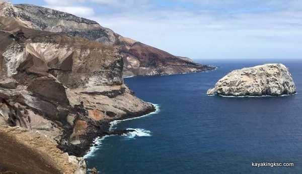
Ascension Island as seen from the Letter box hike
The following information and history was emailed to me.
Consequently I can offer no proper credit to whomever the author is. I do not know the source.
I emphatically take no credit for the following work except having lived through some of it.
However it is fascinating read, at least to a former range rat/diver.
Development of the Eastern Range
The Eastern Range had three tracking sites in operation at Cape Canaveral, Jupiter Auxiliary Air Force Base and Grand Bahama Island by the end of 1954.
Range stations were also being built on the islands of Eleuthera, San Salvador, Mayaguana and Grand Turk, and two more stations were under construction in the Dominican Republic and Puerto Rico.*
Those nine stations constituted the first 1,000 miles of the Eastern Range. Under five separate government contracts, submarine cable was laid down the island chain to forge communications links between the Cape and its downrange stations.
The final stretch of submarine cable linking the Cape to Puerto Rico was laid in August 1954, and submarine cable repeater stations were installed between Grand Turk and Mayaguez Auxiliary Air Force Base in December 1954. Mayaguana was ready for operations on 18 July 1955, and Eleuthera, San Salvador and Grand Turk became operational in August 1955. The stations in the Dominican Republic and Puerto Rico became operational on 5 December 1956.
In October 1952, the Air Research and Development Command approved a plan to extend the Eastern Range's length to 5,000 miles to meet SNARK and NAVAHO missile testing requirements.
Antigua, St. Lucia, Fernando de Noronha and Ascension were tentatively selected as host sites, and agreements were negotiated with the governments of Britain, St. Lucia, Brazil and Ascension to authorize construction. The St. Lucia and Ascension agreements were signed on 26 June 1956, and the Brazilian Agreement was signed on 21 January 1957. Following an exchange of notes with the State Department, Britain granted the U.S. access to Antigua on 15 January 1957. The St. Lucia site was activated on 5 December 1956, and Antigua and Ascension were ready for operations in October 1957. The Fernando de Noronha station was activated off the coast of Brazil on 18 September 1958.
Twelve small telemetry ships were positioned downrange to fill in the gaps between Antigua and Ascension in 1957 and 1958.**
The Eastern Range supported its first 5,000-mile-long mission (a SNARK test flight) on 31 October 1957.
Air Force Missile Test Center
5000 Mile Range
The SNARK and NAVAHO prompted expansion of the Eastern Range to Ascension Island in the mid-1950s, but those winged missiles did not become the principal users of the range's most distant outposts.
After a slow start, ballistic missile and space programs took root at the Cape and quickly dominated the range after 1957.
The MATADOR, BOMARC, SNARK and NAVAHO were eclipsed by the Army's JUPITER, the Navy's POLARIS and the Air Force's THOR, ATLAS, TITAN and MINUTEMAN ballistic missile programs. The Army REDSTONE and the Air Force ATLAS were also adapted to support NASA's MERCURY manned space program in the early 1960s.
With regard to the range's tracking systems, the Eastern Range was equipped with single-point radars initially. Those radars were designated "MOD I" and "MOD II" radars because they were derived from World War II vintage SCR-584 radar systems. The MOD I was the most economical solution for winged missile requirements, and it was replaced by a MOD II version as winged missile flights continued.
By the end of 1957, the range's optical systems included long-range tracking telescopes, infrared tracking equipment, cinetheodolites and ribbon-framed cameras. CZR-1 ribbon-framed cameras covered the missile during the first 1,000 feet of flight, and cinetheodolites followed the vehicle out to a distance of 20 miles. Wild BC-4 ballistic cameras captured optical data beyond the tracking radars' beam widths, and they obtained time-position data for ballistic missile staging events and reentry phenomena. Long-range telescopes tracked vehicles as much as 200 miles downrange. Infrared cameras tracked missiles in the dark.
To meet more stringent ballistic missile test requirements, several systems were designed, procured and added to the Eastern Range's instrumentation in the 1950s and 1960s.
The AZUSA continuous wave tracking system was added to the Cape in the mid-1950s and Grand Bahama in the early 1960s. The AN/FPS-16 radar system was introduced at the Cape, Grand Bahama, San Salvador, Ascension and East Island*** between 1958 and 1961. In the early 1960s, the MISTRAM (Missile Trajectory Measurement) system was installed at Valkaria, Florida and Eleuthera Island to support MINUTEMAN missile flights.
During the same period, the UDOP (Ultra-High Frequency Doppler) trajectory measuring system and an AN/MPS-25 radar were added to Grand Bahama's Cays and Carter Cay to track the Army's PERSHING ballistic missiles. In 1962 and 1963, the AN/FPQ-6 radar system (or its transportable version, the AN/TPQ-18) was installed at Patrick, Antigua, the Cape, Grand Bahama, Grand Turk, Ascension and a site acquired near Pretoria, South Africa in February 1961.
The Eastern Range's FS-type telemetry ships were retired in 1960, but two larger and more capable instrumentation ships, the Twin Falls Victory and the American Mariner, were added to the range's operations in November 1960 and July 1963. Two Advanced Range Instrumentation Ships (ARIS), the USNS General H. H. Arnold and the USNS General Hoyt S. Vandenberg, became operational in 1964. Five APOLLO instrumentation ships were accepted by the Air Force in 1967 and 1968 for support operations in the Pacific. One of the ships (the USNS Redstone) was transferred to the Eastern Range at the end of 1969. The Eastern Range gave up its six C1-M-AV-1 telemetry ships in 1968 and 1969.
Together with its land and sea assets, the Eastern Range relied on specially instrumented aircraft for communications and telemetry support. The 6550th Operations Squadron used C-54 aircraft for range support in the 1950s, but the C-54s were replaced with eleven C-130s in 1961 and 1962 to provide greater speed, longer range and higher altitudes for telemetry reception.
As the APOLLO program got underway in the 1960s, there was a requirement for more capable Advanced Range Instrumentation Aircraft (ARIA). The ARIA were developed to support the APOLLO program initially, but they were also used on Defense Department missions. The Air Force Eastern Test Range accepted the first of eight C-135A aircraft for the ARIA program in January 1966. Those aircraft were modified by the Douglas Aircraft Company in Tulsa, Oklahoma in 1967, and they were returned to Patrick later in the year. Each ARIA carried a steerable telemetry antenna in a "droop snoot" housing at the front of the aircraft. The 6549th Consolidated Aircraft Maintenance Squadron maintained the ARIA at Patrick AFB until the aircraft were transferred to the 4950th Test Wing at Wright-Patterson AFB, Ohio in December 1975. The ARIA were reassigned to the 452nd Test Squadron at Edwards AFB, California in the early 1990s. Despite those organizational changes, the ARIA continued to support Eastern Range missions throughout the period.
When we look back on its development in the 1950s, we realize that the Eastern Range's growth had been nothing short of spectacular: by January 1960, the Eastern Range included 13 major stations, approximately 91 outlying sites, a fleet of ships and three marine support stations. By September 1963, the Eastern Range extended around the tip of South Africa to the island of Mahe in the Indian Ocean.
The manned space program was well underway by the mid-1960s, and the Navy's POSEIDON missile program was scheduled to begin flight testing in 1968.
Despite those obvious signs of prosperity, many of the Eastern Range's old missile and space programs matured or disappeared by the late 1960s.
Budget restrictions were increasingly tight, and there were only a few viable space and missile programs in prospect for the 1970s. Under the circumstances, Air Force planners were compelled to downsize many range assets, and the Air Force began deactivating stations in the early 1960s.
Following the last SNARK launch in December 1960 and the last MERCURY mission in May 1963, half a dozen range stations were retired. The Mayaguez station was deactivated in August 1961, and the East Island Annex was inactive after 1963. The range's annexes in the Dominican Republic were given to the Dominican Government on 6 November 1962. Project FRESH LOOK eliminated the MOD II radar network in 1965. The range station on San Salvador was placed in caretaker status in March 1965, and it was officially closed on 31 January 1970. Range property on St. Lucia was either transferred to the Government of St. Lucia or eliminated by early December 1967. Apart from the airfield, all Mayaguana facilities were abandoned on 16 June 1970. The Missile Guidance Annex on Fernando de Noronha was returned to Brazil on 14 January 1969.
The APOLLO Lunar Landing program and the POSEIDON and MINUTEMAN III Research, Development, Test and Evaluation programs were completed in the early 1970s. Their termination prompted Project RESIZE.
Under RESIZE, the AN-TPQ-18 radars on Grand Bahama Island and Ascension were transferred to the Pacific, and the range's MISTRAM and UDOP systems were deactivated. Grand Turk's command/destruct system was retired. The range's station on Eleuthera was transferred to the U.S. Navy on 1 July 1971. The radar and telemetry systems at Station 13 (Pretoria, South Africa) were mothballed in December 1969, and the property was returned to the Republic of South Africa on 8 January 1996.
Finally, as a result of the Strategic Systems Test Support Study and the Eastern Test Range Facility Utilization Study (ETRFUS) in the early 1980s, the USNS Arnold was decommissioned, the USNS Vandenberg was mothballed and the range station on Grand Turk was deactivated. Jonathan Dickinson Missile Tracking Annex was built near Jupiter, Florida to replace the range station on Grand Bahama Island with the Eastern Range's first modern consolidated instrumentation facility.
The Grand Bahama station was placed in caretaker status on 30 June 1987, and the keys to the station were turned over to the Government of the Bahamas on 30 January 1988.
Following the Shuttle Challenger disaster on 28 January 1986, the national space recovery effort included a revitalization of America's unmanned space vehicle industry. Altogether, contracts worth more than $14 billion were signed for new launch vehicles including the TITAN IV, DELTA II and ATLAS II. Refurbishment of Cape Canaveral's launch pads followed in the late 1980s and early 1990s, and there was an on-going effort to modernize the Eastern Range with a new Range Operations Control Center (ROCC), fiber optics communications, consolidated instrumentation facilities on Antigua and Ascension and radar, telemetry and optics improvements.
The USNS Redstone was deactivated on 6 August 1993, but a new range site was completed in Argentia, Newfoundland in June 1993 to support northbound flights of the TITAN IV from Cape Canaveral. Operational testing for the ROCC continued in 1993 and 1994, and the ROCC was declared operational on 1 March 1995.
The capstone of the Eastern Range's revitalization program was the Range Contractor's relocation of radar, telemetry and command instrumentation at new consolidated instrumentation facilities on Antigua **** and Ascension and the introduction of new telemetry and flight safety system software in the early 2000s. On 3 November 2000, ITT Industries (Systems Division) was awarded the Spacelift Range System Contract to carry out the Improvement and Modernization (I&M) program on the Eastern Range.
During the range's next "downtime period" (18 August through 20 September 2001), contractors installed switches that allowed the range to operate with either the old Range Safety/Range Control System or the new Centralized Telemetry Processing System/Flight Operations Version 1 of the new Flight Safety System. From August through October 2002, contractors conducted an Operational Test Readiness Demonstration of recent improvements.
Based on the results of the demonstration, Headquarters Air Force Space Command granted permission to conduct a Force Development Evaluation (FDE) from early December 2002 through 24 January 2003. Additional efforts by the 45th Space Wing, the Space & Missile Systems Center, and both agencies' contractors yielded very positive results in 2003. The Integrated Satellite Communications/Centralized Telemetry Processing System/Flight Operations Version 1 (ISCF) passed its Readiness Review Board on 17 September 2003. Brigadier General J. Gregory Pavlovich (45th Space Wing Commander) accepted the ISCF on behalf of the Eastern Range on 18 September 2003.
Footnotes
* Construction on Grand Turk was authorized under the Jamaican Agreement, which was signed by Britain and Jamaica on 15 January 1952. An observation station was authorized in the Dominican Republic under the Dominican Agreement, which was signed on 26 November 1951.
** All twelve ships were modified World War II cargo vessels. Six were FS-type ships and six were C1-M-AV-1 vessels. The FS ships were named Echo, Foxtrot, Golf, Hotel, India and Kilo. The C1-M-AV-1s were the Timber Hitch, Coastal Sentry, Rose Knot, Coastal Crusader, Sword Knot and Sampan Hitch. In addition to telemetry systems, the Coastal Sentry and Rose Knot were equipped with command/control transmitters.
*** Station 9 at Mayaguez, Puerto Rico was deactivated in August 1961, but its submarine cable remained in operation to support the East Island Missile Tracking Annex, which was activated in April 1961. East Island's radar was deactivated in September 1963, and the range disposed of the East Island Annex on 16 February 1967.
**** After more than 50 years of
operations, Antigua Air Station was deactivated July 7, 2015 in a
ceremony held on the island.
Brig. Gen. Nina Armagno, 45th Space
Wing commander and presiding officer of the ceremony, sheathed the
detachment colors in a sleeve, symbolizing the organizations inactive
status, while the Honorable Larry Palmer, ambassador to the U.S.
Embassy Barbados, the Honorable Gaston Browne, the Prime Minister of
Antigua and Barbuda, and his Excellency Sir Rodney Williams, the
Governor-General of Antigua and Barbuda, and his wife Lady Sandra
observed the event.
Originally established as a revision of a
land-lease agreement with Great Britain, the mission of Detachment 1,
45th Operations Group, was to support the space-lift mission of the
Eastern Range by providing high data rate telemetry.
"Antigua
Air Station has been an extremely valuable asset to the success of
the 45th SW. It served as one of the primary Range and Control
instrumentation sites for space and launch vehicle tracking support,"
said Armagno. "There was never a launch scrub due to a failure
of Antigua based instrumentation. This is remarkable considering
there was no redundancy for the Antigua radar or command system."
A
thorough review of mission requirements in recent years determined
that the mandatory tracking and command responsibilities that were
carried out by AAS could be accomplished using the data rate
telemetry received from other Air Force assets.
"Mission
requirements for space and launch vehicle tracking support were
reviewed, and we discovered that we are able to provide the necessary
capabilities with mission design changes and use of the telemetry
system on Ascension," said Lt. Col. Steven Melvin, commander of
Det 1.
The decision to inactivate the air station was a difficult
one to make, according to Armagno, but in the constrained fiscal
environment, the wing was forced to make changes. Operating expenses
for AAS were over $10 million USD per year.
In his comments,
Palmer described the moment as "historic though bittersweet."
The ambassador said the partnership between the U.S. and Antigua and
Barbuda has and will continue to benefit both nations in the
future.
The C-Band Radar used in AAS is being relocated to Harold
E. Holt Naval Communications Station, Australia. Once established,
the sensor will be integrated into the U.S. Space Surveillance
Network.
"Many of our allies and partners rely on the U.S.
SSN to provide foundational elements for protecting space assets,"
said Melvin. "The resulting increase in battlespace awareness
due to the location in Australia will provide the warfighter with
predictive and actionable situational awareness through early
detection of launches at a lower inclination than previously
available."
Armagno thanked the detachment and the CSR team
for their support to the 45th SW.
"The 45th Space Wing will
never forget the contributions that Antigua Air Station has provided
over the past 50 years. We will never forget the support that this
Air Station has provided and the wonderful people that have helped
get our mission accomplished," said Armagno. "Today is a
hard day, but you should be gratified. Be proud of everything that
you've stood for and be satisfied for a job well done and know that
you will always hold a special place in the storied history of space
launch for the Air Force and the United States of America!"
WOW! Past and future space programs.
Would like to point out again, that this information was emailed to me and I take no credit and have no knowledge who composed the amazing information.
However I was lucky enough to have met the people who had worked on the closed sites, the existing sites and the tracking ships. And many of the people who worked the tracking sites now work on current NASA and USAF programs so every now and then see a face I recognize.
And there is an annual reunion at Lone Cabbage Fish Camp on the St. Johns River west of the space center.

Return HOME from History of the Air Force Test Range page

My next book!! "Surviving Kennedy Space Center"
on Amazon.
Peek behind the curtains of the Shuttle and Artemis programs.

(Second to newest) My newest book, available on Amazon
(paperback and e-book)
For pet lovers around the globe, "It's a Matter of Luck" is a collection of heart warming stories of horse rescues from the slaughterhouse.
Available on Amazon

It's a Matter of Luck: Inspirational, Heartfelt Stories of Horses Given a Second Chance.
by Kim Ryba & Lina T. Lindgren
Warning: This book may cause your eyes to water in a good way. (speaking from experience after reading it)
Please give Kim and Lina a heartfelt review on Amazon!

Author Bruce Ryba at Kennedy Space Center Launch Pad 39B & Artemis 1. "We are going to the Moon!"
Author's discussion (that's me) on You Tube of a book review on Amazon
For the video versions of information, please check out my YouTube Channel (Turkeys, Flintknapping, dive stories etc.)

My fictional series/stories on Florida history:
Freedoms Quest (book one)
Struggle for the northern frontier and other lost tales of old Florida.
Available on Amazon

Desperate times call for bold action.
In a desperate move to retain Florida and protect the treasure-laden galleons on their dangerous return journey to Europe, the King of Spain issues a royal decree offering refuge to all English slaves who escape Florida and pick up a musket to defend the coquina walls of Saint Augustine.
In another bold gamble, the King offers refuge to the dissatisfied Indian nations of the southeast who will take up arms against the English.
Clans, traumatized by war and disease, cross the Spanish Frontier to settle the cattle-rich land and burned missions of Florida.
Follow the descendants of the conquistador Louis Castillo in remote Spanish Florida, a wild and swept by diseases, hurricanes, and northern invasions.
Book Two: End of Empire Available on Amazon!