- Working at KSC
- NASA Old Headquarters building on KSC destroyed.
- Flintknapping points
- Vampires of Kennedy Space Center and the O&C
- Demons of Kennedy Space Center
- Demons of Kennedy Space Center, corpus callosotomy
- Ghosts of Kennedy Space Center, End of Spiders
- Dreams of Kennedy Space Center, lovers and pyramids.
- Witches of Kennedy Space Center
- Cave Bears of Kennedy Space Center
- Aliens of Kennedy Space Center, uninvited guests
- Remembering Kennedy Space Center
- Lake 33 Killing Relic
Spanish Exploration of the Space Coast and Indian River Lagoon
William Bartram an American naturalist east explored Florida in 1774. His book "Bartrams Travels" is a fascinating journey back in time where he described his encounters with the cattle wealthy Seminoles and the exotic Florida landscape.
His description of Banana Creek on present day Kennedy Space Center: "Clear Flowing water with oyster beds" Today, Banana Creek has been cut in half with fill to create the space program "Crawlerway" for the Apollo, Space Shuttle and SLS rockets.
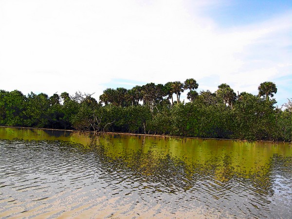
Indian River Lagoon
Batrams other writings described the ambitions of the Creek Indian confederation, their hatred of the Yamasee Indians in Spanish Florida and the Powerful Chickasaws to the west of the Creek lands.
Unfortunately, his writings on cattle rich Florida, probably caused many greedy Americans from across the southeast to turn their attention on Spanish Florida; ultimately leading up to the so called "First Seminole War" that was essentially an invasion across the Spanish Frontier to grab as many Seminole cattle and freed African slaves as could be captured. (my opinion only)
(Please ignore the comment above. This page is about the Spanish)
Whatever the causes of past Florida conflicts: William Bartram's book is fascinating to read about a lost Florida.
However equally fascinating and a more exotic version/concept is the Spanish exploration of the east coast of Florida during a brief lull in hostilities between Ais Indians and the King of Spain.
More exotic, only because William Bartram's time was closer to the modern version of history; whereas the Spanish recorded the people and customs- of an even older lost history of the Florida Indians- before disease, conversion and slave raids radically altered the cultures and genetic make up of this earlier, stranger Florida.
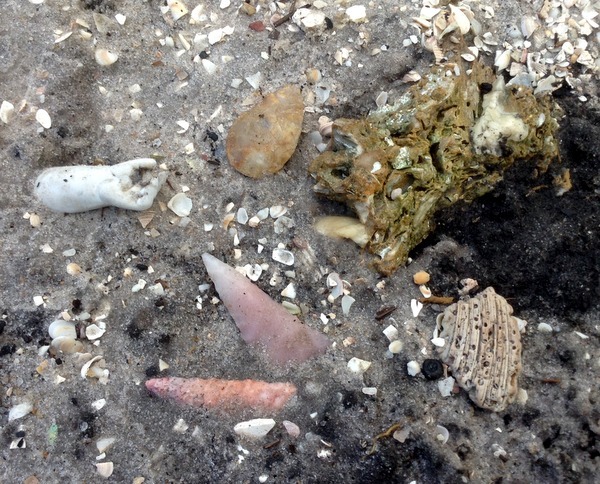
Ais Artifacts, surface finds discovered near the beach in south-central Brevard County during a trash clean up of a beach-side modern homeless camp
Old and new world clashed on the beaches of Florida
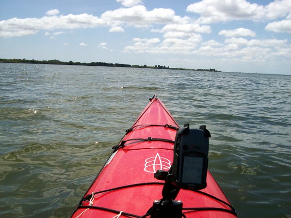
Álvaro Mexía on orders from the Governor of St. Augustine created a detailed map while exploring and recording the people and towns along the east coast. His journey is still easy to follow to this day and makes for an interesting kayak trip.
From June 1605 to July 1605 (mosquito & hurricane season on the east coast) Mexía mapped the coastal area of East Florida from Matanzas Inlet south to Hobe sound.
The unknown Ais Coast of Florida
(modern Pattillo Creek north of the space center)
Alvaro Mexia’s 1605 Derrotero (writings) have been translated by Charles D. Higgs
Some of the more interesting facts recorded by Mexia:
**The existence of inlets through the barrier islands, which over the years have been closed or opened by the onslaught of hurricanes.
**Gravel bottoms on most streams and lagoons, whereas today they are fish killing muck bottoms.
**Mexía notes the crossing the inlet of Jean Ribault (site of execution of a surrendered French army)
** Fresh water at River of Nocoroco (formally the head waters of the modern Halifax Creek/River
**Fresh water at Turnbull Creek
** The Timucua town of Nocoroco on the point where the Tomoka River empties from the uplands.
(Admission: Tomoka is one of my favorite state parks)
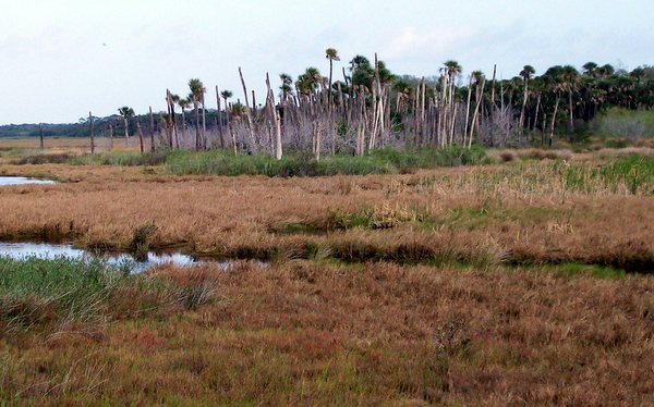
The old town/midden of Nocoroco is in the background
Excerpts from Alvaro Mexia’s 1605 Derrotero as they paddled south from Nocoroco
Around Ponce Inlet
Ponce Inlet (Bar of Mosquitos)
"You navigate the canoes through this bayou so as not to pass over the Bar of Mosquitos (which you take in going to Surruque). The bayou runs to the south for the distance of one-half league, where it makes a bend and turns to the west, leading past the woodland wherein stands the town of Caparaca. There the Nocoroco (river) terminates."
View from Surruque Mound
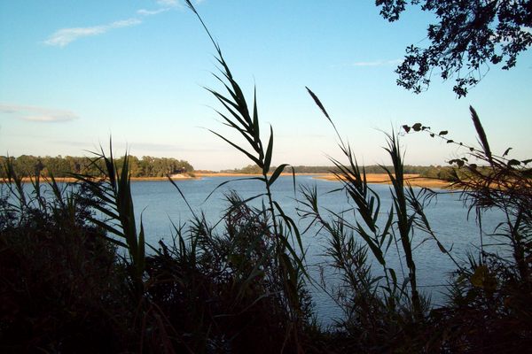
Turtle Mound
"All the way through the mangroves the river proceeds to the southeast, and on the eastern shore there are gullies, palm-groves, and clumps of low evergreen oaks. There are frequent small meanderings and it passes close by the buhlo which is named for Surruque, which is a mound of oyster shells and low shrubs. At the foot of this mound the Indians launch their canoes to go out to sea."
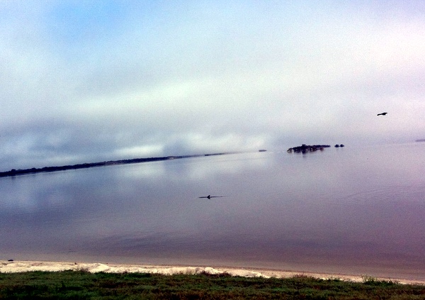
Mosquito Lagoon (Lake Surrugue)
At the south end of the lagoon you enter the Province of Ais
Mosquito Lagoon (Lake Surrugue)
"From there on (as I have said) the river, with many turnings, veers to the southwest for a distance of one and one-half leagues until it issues into the Lake of Surruque. This river is all deep and navigable for small vessels of shallow draught Continuing with the canoes, you quit the river and take a bayou which leads off on the west shore. All along the before mentioned highland are hamlets and dense mangroves. This bayou will [be found to] stretch for a length (as measured by a good look backwards) of seven leagues up to where it leaves the said lake.
At a distance of one league is the town of Old Surruque on a mound. The said lake is broad and long. A channel runs through the middle, which I am informed by the Indians has three crossings in some parts, and where less there are two.
The said woodland ending, you follow a low land with a flat crown of scattered woods, and in back of this low land a high pine land can be seen, which is the mainland, over which [the people] of all this peninsula communicate with those people of the lagoons and the above mentioned River of San Mateo.
They have their towns at Colucuchia, Pia, Chinianeayo, and Perguymolaud [which are] towns on the said river. Along the high ground are hamlets continuing for the distance of a league where there is the principal town of Surruque, and there the Cacique resides.
Along the east shore the mangroves continue and some low dunes where the sea dashes. The lagoon (or lake) [of Surruque] with its town of Surruque is one-half league distant west from the coast. This lagoon runs from northwest to southeast up to the town of Urribia, which is-one and a half leagues distance from Surruque, and at a place where the land forms two points-one on the east side in the mangroves, and the other on the mainland. On this latter point is the town of Urruya.
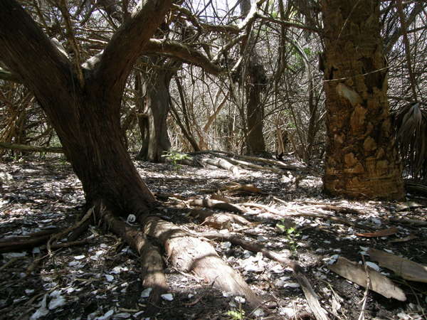
The town of Urruya (also called Oribia) or rather the shell mound that remains.
This was not really difficult to find and I like to describe to anyone who will listen, that the shell mound is at least 200 yards in length. Of note: the midden is continually "plowed" up by feral hogs.
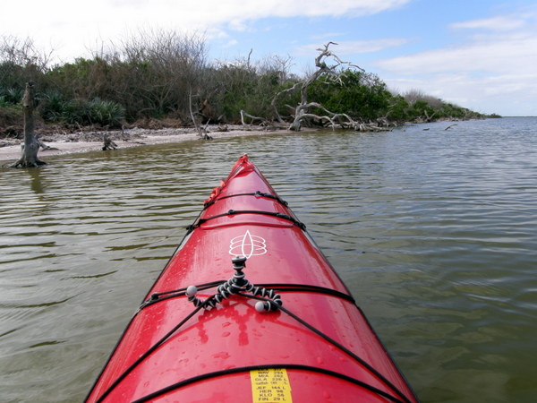
Lagoon opens up to my favorite part around Canaveral National Seashore
"From there on the lagoon widens out and runs north-northwest to south-southeast for a distance of two leagues, where it terminates. On the west shore on the flats made by the end of the lagoon is a village called Suyagueche.
Directly opposite, in a north and south direction, two entrances open through a mangrove swamp which serrates the lagoon. Take the opening on the west, and at a little distance they reunite and proceed, with many turns and meanderings, all the way south easterly through open flat lands with scattered mangroves.
This channel extends three leagues from the entrance to the gullies about the beach, where it terminates, This terminus is between the points of the cape and there the canoes are portaged for the length of the distance between the said dead-end and the of a little river which comes out of the big bay of Ais."
Portage was through NASA and CCAFS.
Photo credit: NASA
At this point I became a little concerned with Alvaro Mexia’s writings, but finally realized "I" was expecting Mixia to cross the from Mosquito Lagoon to the Indian River at the well known Haulover, near the present Haulover Canal.
What Mexia is describing in the above paragraphs is south Mosquito Lagoon, Max Hoeck Creek which ends at modern Playlinda Beach on Canaveral National Seashore & portage across modern day Kennedy Space Center.
Not the "haulover" into the big lake of Ais (modern Indian River)
Of note: castaway Jonathon Dickinson, describes the same portage through modern day Kennedy Space Center and Cape Canaveral Air Force Station. And the "worst mosquitos in Florida" which I can attest is an honest account.
"This haulover the Indians call Potopotoya. The end of the river which comes out of the said bay approaches so close to the sea that there is not more than thirty pasos from one water to the other"
Once again, I can attest, Mexia is describing Max Hoeck Creek, or the settlement at Eddy Creek and not the "Haulover" on the west side of the lagoon.
The "Haulover"
On the western isthmus that separates modern day Indian River and Mosquito Lagoon.
For thousands of years, canoes were carried between the two bodies of water.
The Haul Over (portage) trail before the various versions of Haulover canal were constructed.
The Indian River (Ais Lagoon) & the Province Ulumay
"This river is all gravel bottomed and in the middle are many mangrove keys, and at a distance of a land-league is an island of oaks and small live-oaks. In the whole channel there is no other islet of live-oaks save this one. Here is the town of Ulumay, the first one of the Province of Ais. In back of and adjacent to this town there are many camps.
Following this gravelly-bottomed water-course which flows north and south for one half league from the town, you find] that it diminishes and there are two openings. The one which leaves on the left-hand runs to the southeast, and the other to the southwest, and both reunite at a league's distance. In the channel which runs to the southeast, where it joins with the aforementioned of the town of Ulumay, there are many other encampments in the winter-time, as occur throughout all the high ground of the coast. This is a province called Ulumay.
A province called Ulumay (Merritt Island)
Lagoon of Saboboche: the Banana River & Lagoon of Savochequeya: Newfound Harbor, the deep indentation at the southern end of Merritt Island.
"Near these two channel mouths you enter a very wide lagoon called Saboboche, where low-lying land runs along the east shore for two leagues. Then follows a high pine land, with scattered clumps of wood. These pine woods continue for five leagues and then end. Then a mangrove point extends for a quarter of a league."
"On the western shore there is another narrower lagoon which ends after running north for a league's distance from the said town of Ulumay.
On the east bank at the mouth of this lagoon is the town of Savochequeya, from which the lagoon takes its name.
A thicket with scattered low pines runs along the west shore for two leagues, where it ends, and then mangroves and a tall palm-grove of that species called Royal follow for a distance of a quarter of a league, where the lagoon ends. This lagoon runs north and south, girdled by the aforesaid mangroves on the east and by a low mangrove swamp which is quite rocky on the west, where there is a narrow pass which stretches for one-half league to flow out into the Great Bay of Ais.
This narrow pass (Dragon Point of Merritt Island) runs north and south, and at the mouth of its outlet in the winter-time is the town of Pentoaya. Directly opposite on the western mainland is the same said town in the summer.
This bay, which runs from north to south without a single turn, is very wide and deep.
Along the western highland runs a high pine growth with scattering patches of woods." (Modern Rockledge)
On the east shore are two little cone-shaped mounds, and from there on stretches a low and with palm groves, dunes, and patches of chaparral and brush. This bay extends for a and there is a mangrove swamp
There are two mangrove islets in the middle of the bay, one large and the other small, beyond which the bay narrows and is shallow. At a distance of a league a little fresh water channel, Present day Eau Gallie River) which discharges from the hinterland, enters on the west shore.
The pine woods continue farther, and by a mangrove swamp on the east side at a distance of one and leagues is the Principal Town of the Ais. The bay proceeds on to the south as I have said [?], for a distance of two leagues and then veers to the east and flows out to sea over the Bar [of Ais. (Old Vero Beach Inlet)
The Great Bay of Ais, or the upper reaches of the Indian River, from Eau Gallie up past Titusville.
Return by way of the bay just mentioned, and take the said Pentoaya narrows, and do not navigate the great bay because west of and in back of the town of Ulumay it is a lake so large that land is out of sight, and little though the wind may be, it kicks up a sea
For the above reason, and because there are no inhabitants [on it] do not navigate the said bay and lagoon but take the above mentioned narrows up to the town of Ulumay, and thence the previously described water-course, which runs northwest with many small meanderings (some to the south and others to the north), until it debouches into the said large lagoon a bay that runs to the north. On the west the before mentioned pine woods continue, and on the east the tall mangroves. At a distance of four leagues there is a creek running east and west with the town of Urruya. There disembark in some live-oak savannahs. From the landing place on the bay to the lagoon it is 1200 steps. It is here that the Indians portage their canoes from one water to the other.
The said bay runs to the north until it is in line, northeast and southwest, with the town of Surruque, where it terminates. Here there is a little fresh-water river entering from the hinterland through a long cut at the northwest. This is as far as the canoes can come and is the portage. Briefly you disembarl{ [reimbark?] at Urruya, and taking the Surruque lagoon, and continuing the route north in the order given, you come to the city of St. Augustine."
ALVARO MEXIA
Note: I am working on a theory that Mexia, writing of his return north just described Banana Creek, to Happy Creek then portaged 1200 steps to sections of Max Hoeck Back Creek and into the Mosquito Lagoon. "Maybe"
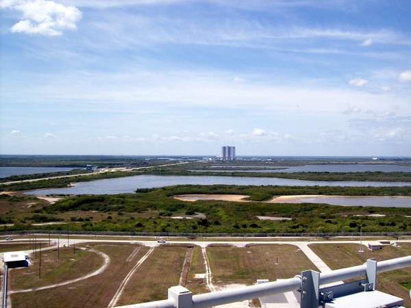
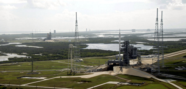
Banana Creek, sealed in half in 1964 to roll the Saturn moon Rockets from the VAB in the background.
Photo taken from Launch Pad A (now the SpaceX pad)
Photo Credit: Mine!
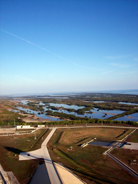
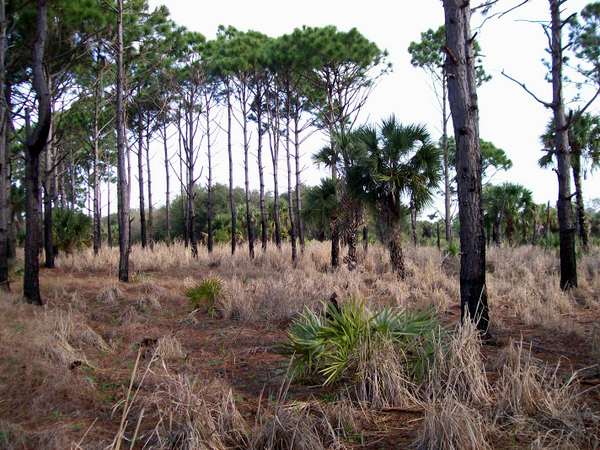
Looking north towards the remoter sections of Max Hoek back creek (Mosquito Lagoon).
Photo taken from the lightning tower at Launch Pad B (SLS pad)
Photo credit: Mine!

Return Home from Spanish Exploration of the Space Coast and Indian River Lagoon page.

My next book!! "Surviving Kennedy Space Center"
on Amazon.
Peek behind the curtains of the Shuttle and Artemis programs.

(Second to newest) My newest book, available on Amazon
(paperback and e-book)
For pet lovers around the globe, "It's a Matter of Luck" is a collection of heart warming stories of horse rescues from the slaughterhouse.
Available on Amazon

It's a Matter of Luck: Inspirational, Heartfelt Stories of Horses Given a Second Chance.
by Kim Ryba & Lina T. Lindgren
Warning: This book may cause your eyes to water in a good way. (speaking from experience after reading it)
Please give Kim and Lina a heartfelt review on Amazon!

Author Bruce Ryba at Kennedy Space Center Launch Pad 39B & Artemis 1. "We are going to the Moon!"
Author's discussion (that's me) on You Tube of a book review on Amazon
For the video versions of information, please check out my YouTube Channel (Turkeys, Flintknapping, dive stories etc.)
My fictional series/stories on Florida history:
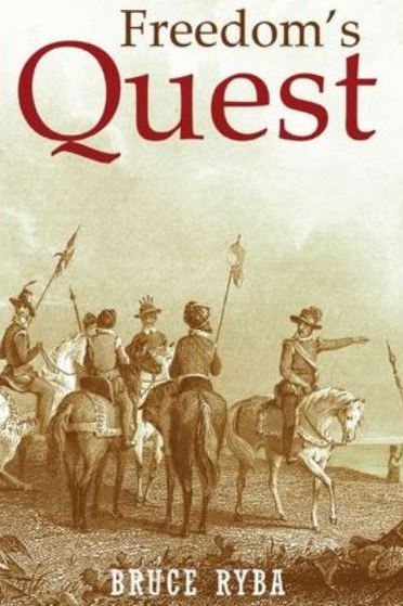
Freedoms Quest (book one)
Struggle for the northern frontier and other lost tales of old Florida.
Available on Amazon

Desperate times call for bold action.
In a desperate move to retain Florida and protect the treasure-laden galleons on their dangerous return journey to Europe, the King of Spain issues a royal decree offering refuge to all English slaves who escape Florida and pick up a musket to defend the coquina walls of Saint Augustine.
In another bold gamble, the King offers refuge to the dissatisfied Indian nations of the southeast who will take up arms against the English.
Clans, traumatized by war and disease, cross the Spanish Frontier to settle the cattle-rich land and burned missions of Florida.
Follow the descendants of the conquistador Louis Castillo in remote Spanish Florida, a wild and swept by diseases, hurricanes, and northern invasions.
Book Two: End of Empire Available on Amazon!