- Working at KSC
- NASA Old Headquarters building on KSC destroyed.
- Flintknapping points
- Vampires of Kennedy Space Center and the O&C
- Demons of Kennedy Space Center
- Demons of Kennedy Space Center, corpus callosotomy
- Ghosts of Kennedy Space Center, End of Spiders
- Dreams of Kennedy Space Center, lovers and pyramids.
- Witches of Kennedy Space Center
- Cave Bears of Kennedy Space Center
- Aliens of Kennedy Space Center, uninvited guests
- Remembering Kennedy Space Center
- Lake 33 Killing Relic
Ulumay
Ais Village of Merritt Island
The Native Americans known as the Ais lived upon the Indian River lagoon, the 156 mile long estuary on the Florida East Coast.
The northern Ais Indians had two major population centers. Kennedy Space Center's Banana Creek and "Ulumay" located at Sykes Creek and New Found Harbor on Merritt Island.
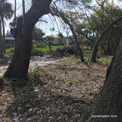
The two photos above were taken from Newfound Habor Drive and were the text photos I was sent and encouraged to come look at the Ulumay shell midden probably destroyed in the 1960's And of course, soon to have someones house and green grass
Bulldozed shell middens at the tip of Merritt Island near the old mound complex.
As I stepped out of my truck....
A small arrow point that had escaped the equipment treads.
Looks to be coral.
Closer view of the small arrow point. Coral?
I put the artifact back. Years ago I made the promise to take photos only. Let the trained folks deal with the rest.
For the last one hundred years the Ais shell mounds have been harvested (raided) for road bed shell and Spanish gold. Then the housing boom of the Apollo Program covered all remains of the old Ais Town of Ulumay.
Or had it?
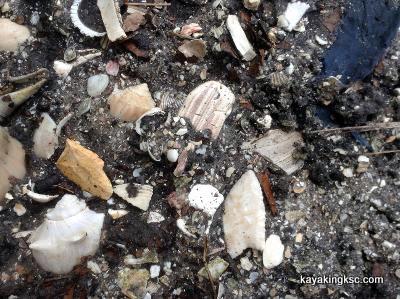
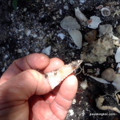
A few feet from Newfound harbor drive, a dart point. Looked to be a nice coral point. By the point type it may have pre dated the shell mound complex. (Left the point there. Taking only photos)
Why this page?
I kayak Sykes Creek and the Banana River and talked about the Ulumay area on my Sykes Creek page.
However the Ulumay town itself has long been developed.
So I had no interest other than bird photography on the current 436 acre Ulumay wildlife sanctuary. And of course my never ending imagination of what the area looked liked, smelled, tasted and so on.
So why this page then?
A couple of things sent me to south Merritt Island. First a series of texts photos on land clearing along New Found Harbor Drive, near Harbor Point Park.
The park provided a convenient Kayak launch and the photos of exposed shell middens were sent to me because that stuff interests me.
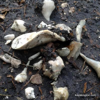
A shell adze, from the lip a queen conch?
So why this page then?
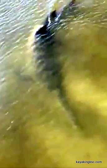
Of course then there was the shark... which got me to load my kayak to a trip to Newfound Harbor.
You know the Great White shark in the Indian and maybe the Banana River.
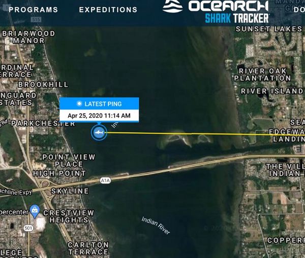
The Great White Shark tracker (Ocearch) was following a white shark off the coast of the space center and 'suddenly' the shark pinged in the Indian River!
The shark named 'Cabot' is tiny at ten feet in length and pings every time the tagged fin breaks the surface and it happened to ping exactly where I do my MR340 kayak race training. (Just north of the 528 Beach line on the west side of Kennedy Space Center)
You Tube video of Cabot the white shark being tagged.
This ping was sort of bizarre, odd, scary and not believable. Except for the Intercoastal Boat channel the Indian River is not deep enough for White Sharks and the salinity is weak.
Bull sharks in the Indian River. Of course. A White Shark?
So the Ocearh data base quickly removed the ping. They did not believe it either. However that same day and the following days, there were several sighting of large sharks in both the Indian and Banana Rivers.
Could have been a bull shark.
What I thought was really interesting, was that the Indian and Banana Rivers were just beginning to clear from a three year deadly algae bloom that killed most of the underwater vegetation and many fish. The water was clearing and big sharks were being spotted.
Less than a week later of the Indian River ping; residents of Merritt Island witnessed a huge animal hunting in the Sikes Creek area of the Banana River. (The Ulumay mound complex area)
They residents did not see fins. Just splashing that was nothing like what they had ever seen before.
Since the Indian River and the Banana Rivers are connected in this area via the Barge Canal and Sykes creek..... I could not resist a kayak trip to the area of the Nessie? As I said, (per Space Coast Daily) the shark ping proved to be an error however the residents of Merritt Island had seen something.
Also I had the texts of the land cleared near Newfound harbor drive.
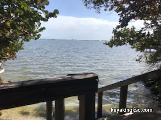
Park near the Ulumay destroyed mounds and middens.
This area is where Sykes Creek merges into the Banana River.
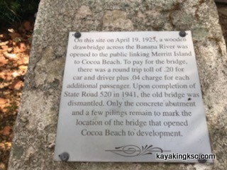
Plaque at the park.
This park was the site for the first wooden bridge (1923) from Merritt Island to Cocoa Beach
(My apology for the picture quality)
Made me realize the Ulumay mounds were pillaged in 1923 for road bed material. Bones of the Ais Indians sit under the now paved road.
Which also explains why the Ulumay mounds were not mentioned in the 1940 Smithsonian book on their east coast digs.
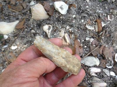
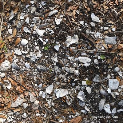
Broken chert/flint on the Ulumay mound remains.
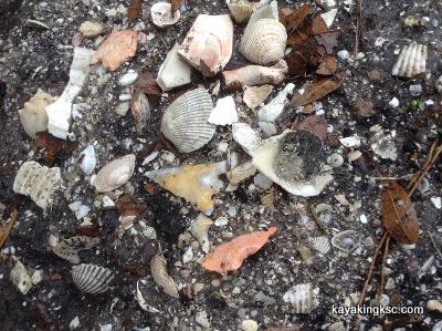
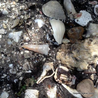
Coral dart point on the Ulumay destroyed mounds.
And about the Nessie/shark sighting.....I have a theory....
Just before the COVID pandemic, I noted the waters clearing in the Indian and Banana Rivers. At least a temporary break in the four year algae bloom (until people begin to fertilize their yards again)
Also noted that the stocks of sea trout are plentiful in the river. Almost pre algae bloom levels. Skinny and smaller, but lots of them.
Into this comes new sightings of large small tooth saw fish. The sawfish's have been extinct in the Atlantic side of the Florida Coast for fifty years.
A few have returned to the Indian River Lagoon and I suspect the residents of Merritt Island, (Sykes Creek/Newfound Harbor/Ulumay may have observed a large saw fish in action, slaying sea trout out in the boat channel.
This of course would be something long time residents had never seen because; well there were no sawfish to be seen feeding.
under construction because I have to get up and work tomorrow
Return Home from Ulumay page

My next book!! "Surviving Kennedy Space Center"
on Amazon.
Peek behind the curtains of the Shuttle and Artemis programs.

(Second to newest) My newest book, available on Amazon
(paperback and e-book)
For pet lovers around the globe, "It's a Matter of Luck" is a collection of heart warming stories of horse rescues from the slaughterhouse.
Available on Amazon

It's a Matter of Luck: Inspirational, Heartfelt Stories of Horses Given a Second Chance.
by Kim Ryba & Lina T. Lindgren
Warning: This book may cause your eyes to water in a good way. (speaking from experience after reading it)
Please give Kim and Lina a heartfelt review on Amazon!

Author Bruce Ryba at Kennedy Space Center Launch Pad 39B & Artemis 1. "We are going to the Moon!"
Author's discussion (that's me) on You Tube of a book review on Amazon
For the video versions of information, please check out my YouTube Channel (Turkeys, Flintknapping, dive stories etc.)
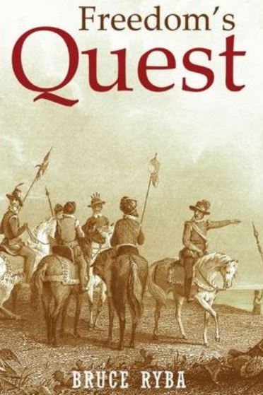
My fictional series/stories on Florida history:
Freedoms Quest (book one)
Struggle for the northern frontier and other lost tales of old Florida.
Available on Amazon

Desperate times call for bold action.
In a desperate move to retain Florida and protect the treasure-laden galleons on their dangerous return journey to Europe, the King of Spain issues a royal decree offering refuge to all English slaves who escape Florida and pick up a musket to defend the coquina walls of Saint Augustine.
In another bold gamble, the King offers refuge to the dissatisfied Indian nations of the southeast who will take up arms against the English.
Clans, traumatized by war and disease, cross the Spanish Frontier to settle the cattle-rich land and burned missions of Florida.
Follow the descendants of the conquistador Louis Castillo in remote Spanish Florida, a wild and swept by diseases, hurricanes, and northern invasions.
Book Two: End of Empire Available on Amazon!